From the Pyrenees to the Canal du Midi
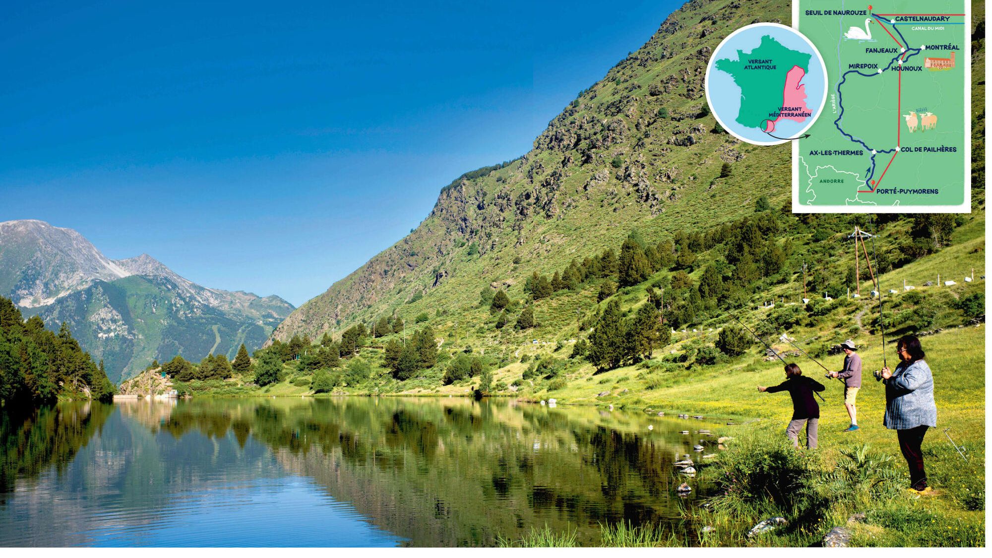
It is at the crossroads of two countries, in a region suspended between heaven and summits, that our journey begins. Objective: to follow this natural border which separates the rivers according to their final destination, the ocean or the sea. It is barely 7 am when I arrive with Hélène, the photographer, in Porté-Puymorens, in the Pyrénées-Orientales, a stone’s throw from Andorra. This village of 143 inhabitants, nestled at 1600 m above sea level, at the entrance to the Catalan Pyrenees Regional Natural Park, is the first French municipality crossed by this water line.
After having surveyed deserted streets, we come across three lève-T-set that tease the stud on the shore of the Lac du Passet, born from a dam on the Carol river in the 1950s. It is at this moment that our little game begins: where this river flows? Towards the “big blue” (the Atlantic Ocean) or towards the “Big Blue” (the Mediterranean Sea)?
Our opinions differ. Hélène puts forward an answer. I express my doubt. And it offers to decide by questioning the trio of fishermen. By way of greeting, I launch a classic “Is it biting?” “Not really, because the wilderness trout of this lake have become intelligent and play with our hooks,” replies Marie-Claude, nicknamed the groundhog. The discussion derives on the declining snow of this renowned ski resort. Then, return to the essentials when Marie-Jeanne and her husband Christian enlighten us: “Carol is a tributary of the Ebre, Spanish river which flows into the Mediterranean. A point for Hélène. Zero for me.
Of spa in thermal cities
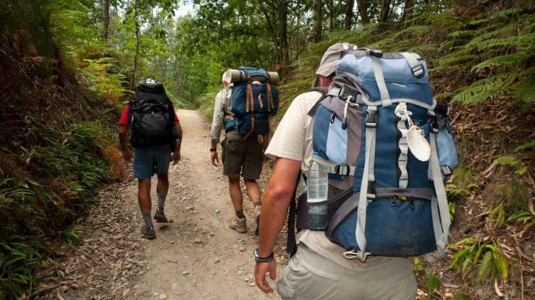
“Where to find the nearest river who joins the Atlantic?” I asked to restore the capacity. Response from fishermen: “You have to cross the Puymorens pass. On the other side, in the Hospital-Annee-l’Andorre, in Ariège, flow the stream of the Bésines and the Ariège river, which are part of the Garonne basin-verse whose mouth is the Gironde estuary. After a coffee at the Hospitalet, we take the road to Ax-les-Thermes. In this city of water, spa guests flock to hot springs to relieve their pain. Trekking enthusiasts are also found on the steep steep slopes with their backpacks and hiking sticks. In the midst of this tumult, Hélène has the good idea to suggest a stop to taste a Croustade, local pastry,, Before attacking, by car, the rise in the port of Pailhères, a pass which culminates at 2001 m.
The 18.5 km of climb, sometimes borrowed by the Tour de France, attract many cyclists. We come across a happy group of young Rhodanians who connect Bayonne to Perpignan to the strength of their calves. Do they know that they pedal on the watershed? “No, but what is certain is that you need solidarity to pedal so high,” jokes one of them. “Sharing efforts!” Another. Jonas, 23 -year -old Swiss and a geology student who climbs solo, is much more informed about the issue. “Sharing water on the surface is one thing, that of underground tablecloths is another … They do not always follow the basins,” he comments skillfully. A difficult assertion to verify.
“Here, there is also a sharing line … bears”
And it is not Roman, 27, shepherd in summer, who will enlighten us more on the direction that surface or underground waters take. On the slope where he grazes his sheep, in the heights of Ascou, he is however an excellent observer of the effects of climate change on the flora. And on the annoying subject in the Ariège Pyrenees, he has the strength to joke. “Here, there is also a sharing line … bears,” he smiles, designating a distant edge. “Sometimes we see one, but he doesn’t approach. On the other hand, the wolves take less their distance, ”he notes, caressing Arka, 5-year-old bastard, and neo, 2 years old, his herd dogs.
The day declines. We descend to the valley by the UBAC (the slope of the shortest exposed to the sun) and reach Mirepoix for the night. The superb Place des Coupère, a jewel of medieval architecture, welcomes our dinner. The next day, crossing the seven -arches’ bridge at the northern exit of the city, it is Hélène who revives the riddle: “In what direction is the hers? My answer: to the Atlantic, via the Garonne. This time, I score a point: I had revised during the night, upset in my defeat of the day before.
GR in collegiates
Twenty-nine kilometers further, we reach Montreal, in Aude. The mayor, Bernard Breil, member of the Association of Friends of the Chemins of Saint-Jacques en Terre d’Aude, welcomes us. He evokes the path of Pyrenean Piedmont, or GR78, which links Carcassonne to Mirepoix, which he and some elected officials and volunteers of the department helped to create twenty years ago and which is now a tourist asset. In the meantime, he showed us around the jewel of his city: the Saint-Vincent collegiate church. Built in the 14th century, it had an astonishing baptistery supported by a sculpted devil, and a monumental organ of four keyboards, 57 games and nearly 4000 pipes.
A stone’s throw away, between Hounoux and Fanjeaux, the GR78 merges with the GR7 and runs along a crest line … battery on the water sharing line. We head for Hounoux under a blazing sun. From a promontory, we perceive on the horizon the castle of Montségur in the south and, to the north, the massive shadow of the Black Mountain. An air of salsa rises: four accomplices repeat for the music festival with guitars and maracas. “Here, the sharing line is first of all conviviality,” says Jacques, inviting us to dance. Gilles, he speaks to us agriculture: here, even the soil is divided. “To the east, in the part of the village including the church and the town hall, the streams slide towards the Aude, the Mediterranean and the wheat fields. To the west, they run towards the Vixiège, then the Garonne and the Atlantic, crossing the vineyards. “Soizic, the singer of the small group, concludes by quoting a local saying:” Here, when it rains, there is a drop that falls on the ocean side and the other sea side. “We leave this festive atmosphere for Fanjeaux, at 8.5 km. On the way, does the game resume: does the course of this stream go to Sète or to Bordeaux?
Fanjeaux and the Lauragais: crossroads of faith, history and flavors
We are starting to become unbeatable. In Fanjeaux, sharing becomes spiritual. It is indeed here that Dominique de Guzman, the future Saint Dominic, preached at the beginning of the 12th century against Catharism and founded the order of preachers. In the parish church, the “Beam of the Miracle of Fire” recalls its victorious oratory game against Guilhabert de Castres, Cathare bishop. She is well protected by Claudette, an octogenarian parishioner who keeps the key and only opens access to this relic to those who, like Hélène and I, sent to the special sent to Pilgrimshow white leg.
Below, at the Monastery of Prouilhe, headquarters of the first Dominican community, founded in 1207, we meet Brother Renaud. He plays the guides for pilgrims from Perpignan and shares with us his theological reading: “This geographical line is also a crossroads of ideas, a no man’s land where humans, cultures, heresies have always met … Here, men have always sought to divide … or bring together.”
We visit the Notre-Dame-du-Rosaire basilica under construction since 1885 and whose completion has been hampered during the decades by many vagaries, before descending to Castelnaudary for the night. An agent of the tourist office enlightens us on one of the symbols of the city: if the cassoulet is king here, it is thanks to Catherine de Médicis, countess of Lauragais before becoming Queen of France. She had the Lingot bean, the main ingredient of the famous stew in the region, brought back from the Americas by one of its cousins.
At the threshold of the Canal du Midi
In the early morning, we join the Naurouze Seuil, twenty minutes away, in the town of Montferrand. Here, the water sharing line becomes tangible. This is the birth point of the Canal du Midi, masterpiece of 18th century civil engineering, connecting Toulouse to the Mediterranean Sea. Its designer, Pierre-Paul Riquet (1609-1680), former farmer general of the gabelles then businessman, made this site, at an altitude of 194 m, the culmination of the canal. Passed thanks to enormous works and a lot of ingenuity, the water of the black mountain flows via the channel, depending on the opening of the locks to the west to the Atlantic, in the east to the Mediterranean. “This project, which lasted fourteen, employing thousands of workers and dozens of engineers, was one of the most pharaonic of the reign of Louis XIV,” explains our guide, Régis Quinta, president of the Association Patrimoine et Culture de Montferrand.
We reach the first lock, that of the ocean, following a pleasant path on foot in the shade of the plane trees. On this site where a 20 m obelisk was erected in tribute to Pierre-Paul Riquet, we observe the ballet of walkers, cycle tourists and boaters. Seeing maneuvering an English captain, we ask him if he agrees to lead us on the other side, to the Mediterranean lock, just under six kilometers. “Yes! He replied. On board, his three compatriots and are surprised to learn, thanks to us, that it is a stone’s throw away that the bief (portion of watercourses between two locks) of sharing of the canal is located. When crossing it, everyone immortalizes the moment by a selfie.
After this “stop boat”, back in Castelnaudary, last stage of our journey, we will greet Charlie one last time, the juggan swan of the large basin of the capital of Cassoulet. The volatile peaceful and lonely reigns on this body of water … without sharing.
Explore
- Lake Font Vive (Estany de Font Viva)
Picturesque rounded mountain lake surrounded by small hills above Porté-Puymorens, at 1886 m altitude. Authorized fishing and swimming.
Information: Pyrenees-Derdagne.com or 04 68 04 82 20.
CURIOSITY
- The aeronautical lighthouse of Montferrand
The airplanes of the Aéropostale needed fixed headlights, on the ground, to find their way from the sky. That of Montferrand, like all those who marked the road to Africa, was equipped with electric tubes with neon in orange red light to unravel the mist.
The pilot was also regularly informed in Morse of the place where he was …
Rens. : Castelnaudary-tourisme.com or 04 68 23 05 73.
A path
This high hike path follows the watershed for more than 1500 km, from the Vosges to the Principality of Andorra. In its Occitan part, the route has twelve steps from Mazamet (Tarn). The path crosses the black mountain before embarking over the water, especially on the Canal du Midi. Then, the Lauragais plain links the Pyrenees.
The last stages take place in the high mountains, to Portella Blanca, where the borders of France, Spain and Andorra converge. To borrow between early June and end of September to avoid snow. Remember to reserve accommodation.